Breaking News
ताज़ा खबर
ताजी बातमी
সর্বশেষ সংবাদ
சமீபத்திய செய்தி
తాజా వార్త
તાજા સમાચાર
ਤਾਜ਼ਾ ਖ਼ਬਰ
New Radar Tech Uncovers Urgent Truth of Sinking Mexico City
मेक्सिको सिटी डूब रही है: नया रडार सिस्टम दे रहा चौंकाने वाला डेटा
मेक्सिको सिटी बुडत आहे: नवीन रडार प्रणालीतून धक्कादायक डेटा समोर
মেক্সিকো সিটি ডুবছে: নতুন রাডার সিস্টেম থেকে উদ্বেগজনক তথ্য প্রকাশ
மெக்சிகோ நகரம் மூழ்குகிறது: புதிய ரேடார் அமைப்பு அதிர்ச்சி தரும் தரவுகளை வெளியிடுகிறது
మెక్సికో నగరం మునిగిపోతోంది: కొత్త రాడార్ వ్యవస్థ షాకింగ్ డేటాను వెల్లడించింది
મેક્સિકો સિટી ડૂબી રહી છે: નવું રડાર સિસ્ટમ આપી રહ્યું છે ચોંકાવનારો ડેટા
ਮੈਕਸੀਕੋ ਸਿਟੀ ਡੁੱਬ ਰਿਹਾ ਹੈ: ਨਵਾਂ ਰਾਡਾਰ ਸਿਸਟਮ ਦੇ ਰਿਹਾ ਹੈ ਹੈਰਾਨ ਕਰਨ ਵਾਲਾ ਡਾਟਾ
By AI News Desk
🕐 09 May 2026, 02:49 PM
📰 Viral and Trending News
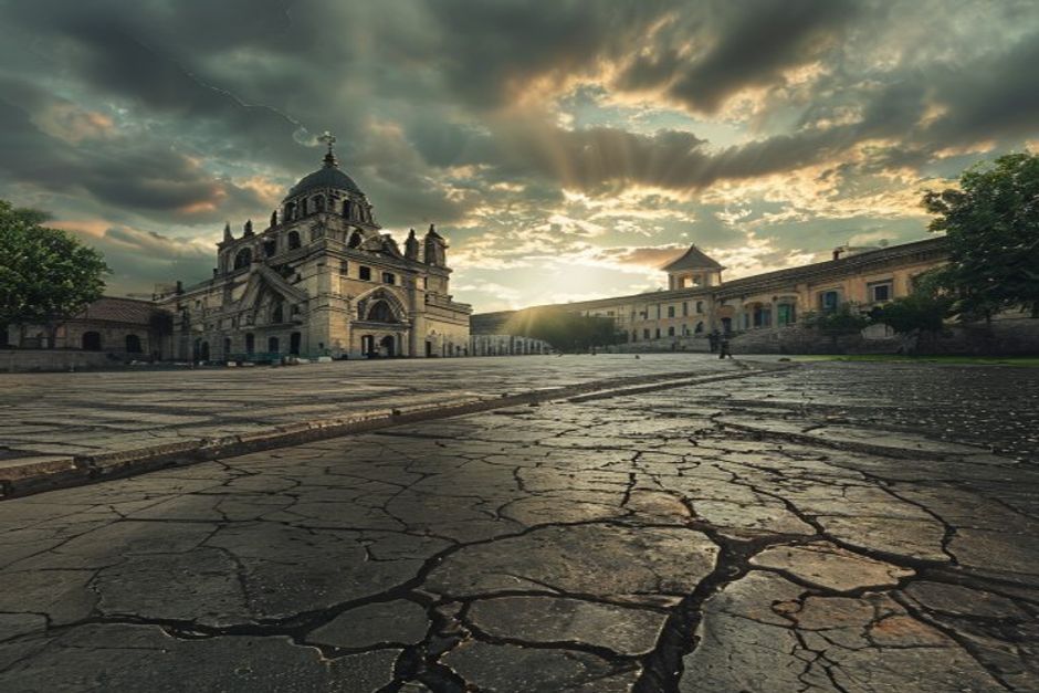
Mexico City’s sprawling central Zócalo offers a truly dizzying experience. At one end, the capital’s majestic Metropolitan Cathedral, with its soaring spires, visibly slumps in one direction, while an attached church, the Metropolitan Sanctuary, tilts sharply in the other. Even the nearby National Palace appears off-kilter. This unsettling teetering of many of the capital's historic buildings is the most visible sign of a geological phenomenon that has been ongoing for more than a century: Mexico City is sinking at an alarming and accelerating rate.
Unraveling the Mystery of Subsidence
The crisis stems from the city's unique foundation, built upon the soft clay of a former lakebed. Decades of relentless groundwater extraction from the underlying aquifer have caused these compressible soils to compact, leading to the city's slow descent. While the problem has long been acknowledged, its true extent and the precise mechanisms driving it have often been underestimated. Now, a powerful new radar system is providing an unprecedented wealth of data, offering experts a clearer, more detailed understanding of the city’s subsidence.
This advanced technology allows researchers to meticulously map the subtle vertical movements across the entire urban landscape, identifying hotspots of rapid sinking and tracking the precise pace of descent. Experts hope that this definitive, quantifiable data will finally draw more urgent attention to the crisis, prompting greater governmental and public investment in sustainable water management and urban planning solutions. Without decisive action, the long-term implications for Mexico City’s infrastructure, its invaluable cultural heritage, and the safety of its millions of residents are dire. The insights from this radar system are not just about measuring a problem; they are a critical step towards engineering a more stable future for one of the world's most vibrant, yet geologically vulnerable, megacities.
मेक्सिको सिटी का विशाल सेंट्रल ज़ोकालो एक चक्करदार अनुभव प्रदान करता है। एक छोर पर, राजधानी का शानदार मेट्रोपॉलिटन कैथेड्रल, अपनी ऊंची मीनारों के साथ, एक दिशा में स्पष्ट रूप से झुका हुआ है, जबकि उससे सटा एक चर्च, मेट्रोपॉलिटन सैंक्चुअरी, दूसरी ओर झुका हुआ है। यहां तक कि पास का नेशनल पैलेस भी टेढ़ा-मेढ़ा लगता है। राजधानी की कई ऐतिहासिक इमारतों का यह डगमगाना एक सदी से अधिक समय से चल रही एक भूवैज्ञानिक घटना का सबसे दृश्यमान संकेत है: मेक्सिको सिटी खतरनाक और तेजी से डूब रही है।
धंसाव के रहस्य को सुलझाना
यह संकट शहर की अनूठी नींव से उपजा है, जो एक पूर्व झील के तल की नरम मिट्टी पर बना है। अंतर्निहित जलभृत से दशकों तक लगातार भूजल निकालने के कारण ये संकुचित मिट्टी दब गई है, जिससे शहर धीरे-धीरे नीचे धंस रहा है। जबकि इस समस्या को लंबे समय से स्वीकार किया गया है, इसकी वास्तविक सीमा और इसे संचालित करने वाले सटीक तंत्रों को अक्सर कम करके आंका गया है। अब, एक शक्तिशाली नया रडार सिस्टम अभूतपूर्व डेटा प्रदान कर रहा है, जिससे विशेषज्ञों को शहर के धंसाव की स्पष्ट और अधिक विस्तृत समझ मिल रही है।
यह उन्नत तकनीक शोधकर्ताओं को पूरे शहरी परिदृश्य में सूक्ष्म ऊर्ध्वाधर हलचलों को सावधानीपूर्वक मैप करने, तेजी से धंसने वाले हॉटस्पॉट की पहचान करने और धंसाव की सटीक गति को ट्रैक करने की अनुमति देती है। विशेषज्ञों को उम्मीद है कि यह निश्चित, मात्रात्मक डेटा अंततः इस संकट पर अधिक तत्काल ध्यान आकर्षित करेगा, जिससे स्थायी जल प्रबंधन और शहरी नियोजन समाधानों में अधिक सरकारी और सार्वजनिक निवेश को बढ़ावा मिलेगा। निर्णायक कार्रवाई के बिना, मेक्सिको सिटी के बुनियादी ढांचे, इसकी अमूल्य सांस्कृतिक विरासत और इसके लाखों निवासियों की सुरक्षा के लिए दीर्घकालिक प्रभाव गंभीर होंगे। इस रडार प्रणाली से मिली अंतर्दृष्टि केवल एक समस्या को मापने के बारे में नहीं है; वे दुनिया के सबसे जीवंत, फिर भी भूवैज्ञानिक रूप से कमजोर, मेगासिटी में से एक के लिए अधिक स्थिर भविष्य को इंजीनियरिंग करने की दिशा में एक महत्वपूर्ण कदम हैं।
मेक्सिको सिटीचे विस्तीर्ण मध्यवर्ती झोकालो (Zócalo) एक चक्रावून टाकणारा अनुभव देतो. एका टोकाला, राजधानीचे भव्य मेट्रोपॉलिटन कॅथेड्रल, त्याच्या उंच मनोऱ्यांसह, एका दिशेने स्पष्टपणे झुकलेले दिसते, तर त्याला लागून असलेले चर्च, मेट्रोपॉलिटन सँक्चुअरी, दुसऱ्या दिशेने कललेले आहे. अगदी जवळचा नॅशनल पॅलेसही वाकडा दिसतो. राजधानीतील अनेक ऐतिहासिक इमारतींचे हे डगमगणे एका शतकाहून अधिक काळापासून सुरू असलेल्या भूगर्भीय घटनेचे सर्वात स्पष्ट चिन्ह आहे: मेक्सिको सिटी चिंताजनक आणि वेगाने खाली जात आहे.
भूभागाच्या खालच्या बाजूस जाण्याचे रहस्य उलगडणे
हे संकट शहराच्या अद्वितीय पायामुळे उद्भवले आहे, जे एका जुन्या तलावाच्या तळावरील मऊ मातीवर बांधले आहे. जमिनीखालील जलचरातील भूजलाच्या दशकांपासूनच्या सततच्या उपशामुळे ही संकुचित होणारी माती दबली आहे, ज्यामुळे शहर हळूहळू खाली जात आहे. ही समस्या बऱ्याच काळापासून मान्य असली तरी, तिची खरी व्याप्ती आणि तिला चालना देणारी नेमकी यंत्रणा अनेकदा कमी लेखली गेली आहे. आता, एक शक्तिशाली नवीन रडार प्रणाली अभूतपूर्व डेटा प्रदान करत आहे, ज्यामुळे तज्ञांना शहराच्या भूभागाच्या खालच्या बाजूस जाण्याची स्पष्ट आणि अधिक तपशीलवार माहिती मिळत आहे।
हे प्रगत तंत्रज्ञान संशोधकांना संपूर्ण शहरी भूभागावरील सूक्ष्म उभ्या हालचालींचे बारकाईने मॅपिंग करण्यास, वेगाने बुडणाऱ्या ठिकाणांची (hotspots) ओळख पटवण्यास आणि बुडण्याच्या नेमक्या गतीचा मागोवा घेण्यास मदत करते. तज्ञांना आशा आहे की हे निश्चित, मोजता येण्याजोगा डेटा शेवटी या संकटाकडे अधिक तातडीने लक्ष वेधून घेईल, ज्यामुळे शाश्वत जलव्यवस्थापन आणि शहरी नियोजन उपायांमध्ये अधिक सरकारी आणि सार्वजनिक गुंतवणुकीला चालना मिळेल. निर्णायक कृतीशिवाय, मेक्सिको सिटीच्या पायाभूत सुविधा, तिचा अमूल्य सांस्कृतिक वारसा आणि लाखो रहिवाशांच्या सुरक्षिततेसाठी दीर्घकालीन परिणाम गंभीर असतील. या रडार प्रणालीतून मिळालेली अंतर्दृष्टी केवळ एका समस्येचे मोजमाप करण्यापुरती नाही; तर ती जगातील सर्वात दोलायमान, परंतु भूगर्भीयदृष्ट्या असुरक्षित असलेल्या मेगासिटींपैकी एका शहरासाठी अधिक स्थिर भविष्याची निर्मिती करण्याच्या दिशेने एक महत्त्वाचे पाऊल आहे.
মেক্সিকো সিটির বিশাল কেন্দ্রীয় জোকালো (Zócalo) এক বিস্ময়কর অভিজ্ঞতা প্রদান করে। এক প্রান্তে, রাজধানীর মহৎ মেট্রোপলিটন ক্যাথিড্রাল, তার উঁচু চূড়াগুলির সাথে, এক দিকে দৃশ্যত ঝুঁকে আছে, যখন এর সাথে সংযুক্ত একটি গির্জা, মেট্রোপলিটন স্যাংচুয়ারি, অন্য দিকে কাত হয়ে আছে। এমনকি কাছাকাছি ন্যাশনাল প্যালেসটিও যেন ঠিক সোজা নেই। রাজধানীর অনেক ঐতিহাসিক ভবনের এই অস্থির অবস্থা এক শতাব্দীরও বেশি সময় ধরে চলমান একটি ভূ-তাত্ত্বিক ঘটনার সবচেয়ে দৃশ্যমান লক্ষণ: মেক্সিকো সিটি উদ্বেগজনক এবং দ্রুত গতিতে ডুবে যাচ্ছে।
ভূ-পৃষ্টের অবনমনের রহস্য উন্মোচন
এই সংকট শহরের অনন্য ভিত্তির কারণে উদ্ভূত হয়েছে, যা একটি প্রাক্তন হ্রদের তলদেশের নরম মাটির উপর নির্মিত। মাটির নিচে অবস্থিত জলস্তর থেকে কয়েক দশক ধরে অবিরাম ভূগর্ভস্থ জল উত্তোলনের ফলে এই সংকোচনশীল মাটি সংকুচিত হয়ে গেছে, যার ফলে শহর ধীরে ধীরে নিচে নেমে যাচ্ছে। যদিও এই সমস্যাটি দীর্ঘকাল ধরে স্বীকৃত, তবে এর প্রকৃত মাত্রা এবং এর পেছনের সুনির্দিষ্ট প্রক্রিয়াগুলি প্রায়শই underestimated করা হয়েছে। এখন, একটি শক্তিশালী নতুন রাডার সিস্টেম অভূতপূর্ব ডেটা সরবরাহ করছে, যা বিশেষজ্ঞদের শহরের ভূ-পৃষ্টের অবনমনের একটি স্পষ্ট এবং আরও বিস্তারিত ধারণা দিচ্ছে।
এই উন্নত প্রযুক্তি গবেষকদের সমগ্র শহুরে ভূখণ্ডের সূক্ষ্ম উল্লম্ব গতিবিধি পুঙ্খানুপুঙ্খভাবে মানচিত্র তৈরি করতে, দ্রুত ডুবে যাওয়ার হটস্পটগুলি সনাক্ত করতে এবং অবনমনের সঠিক গতি ট্র্যাক করতে সহায়তা করে। বিশেষজ্ঞরা আশা করছেন যে এই সুনির্দিষ্ট, পরিমাপযোগ্য ডেটা অবশেষে এই সংকটের প্রতি আরও জরুরি মনোযোগ আকর্ষণ করবে, যা টেকসই জল ব্যবস্থাপনা এবং নগর পরিকল্পনা সমাধানগুলিতে আরও সরকারি এবং জনসাধারণের বিনিয়োগকে উৎসাহিত করবে। সুনির্দিষ্ট পদক্ষেপ ছাড়া, মেক্সিকো সিটির অবকাঠামো, এর অমূল্য সাংস্কৃতিক ঐতিহ্য এবং এর লক্ষ লক্ষ বাসিন্দাদের নিরাপত্তার জন্য দীর্ঘমেয়াদী পরিণতি ভয়াবহ হবে। এই রাডার সিস্টেম থেকে প্রাপ্ত অন্তর্দৃষ্টি কেবল একটি সমস্যা পরিমাপ করার জন্য নয়; তারা বিশ্বের সবচেয়ে প্রাণবন্ত, তবুও ভূতাত্ত্বিকভাবে দুর্বল, মেগাসিটিগুলির মধ্যে একটির জন্য একটি আরও স্থিতিশীল ভবিষ্যত প্রকৌশল করার দিকে একটি গুরুত্বপূর্ণ পদক্ষেপ।
மெக்சிகோ நகரத்தின் பிரம்மாண்ட மத்திய சோகாலோ (Zócalo) ஒரு தலைச்சுற்ற வைக்கும் அனுபவத்தை வழங்குகிறது. ஒரு முனையில், தலைநகரின் கம்பீரமான மெட்ரோபொலிட்டன் கதீட்ரல், அதன் உயரமான கோபுரங்களுடன், ஒரு திசையில் வெளிப்படையாகச் சரிந்து நிற்கிறது, அதேசமயம் அதனுடன் இணைந்த ஒரு தேவாலயம், மெட்ரோபொலிட்டன் சானக்ட்சுவரி, மறுபுறம் சாய்ந்துள்ளது. அருகில் உள்ள தேசிய அரண்மனை கூட சாய்ந்திருப்பது போல் தோன்றுகிறது. தலைநகரின் பல வரலாற்று கட்டிடங்களின் இந்த அசைவு, ஒரு நூற்றாண்டுக்கும் மேலாக நடந்து வரும் ஒரு புவியியல் நிகழ்வின் மிகவும் வெளிப்படையான அடையாளமாகும்: மெக்சிகோ நகரம் அதிர்ச்சியூட்டும் மற்றும் விரைவான வேகத்தில் மூழ்கி வருகிறது.
நிலப்பரப்பு அமிழ்வின் மர்மத்தை அவிழ்த்தல்
இந்த நெருக்கடி, ஒரு முன்னாள் ஏரியின் அடிவாரத்தில் உள்ள மென்மையான களிமண் மீது கட்டப்பட்ட நகரத்தின் தனித்துவமான அடித்தளத்திலிருந்து உருவாகிறது. நிலத்தடி நீர்ப்படுகையில் இருந்து பல தசாப்தங்களாக தொடர்ந்து நிலத்தடி நீரை உறிஞ்சியதால், இந்த சுருங்கும் மண் இறுக்கமாகி, நகரம் மெதுவாக கீழே செல்ல வழிவகுக்கிறது. இந்த பிரச்சனை நீண்ட காலமாக அங்கீகரிக்கப்பட்டிருந்தாலும், அதன் உண்மையான அளவு மற்றும் அதை இயக்கும் துல்லியமான வழிமுறைகள் பெரும்பாலும் குறைத்து மதிப்பிடப்பட்டுள்ளன. இப்போது, ஒரு சக்திவாய்ந்த புதிய ரேடார் அமைப்பு முன்னெப்போதும் இல்லாத தரவுகளை வழங்கி வருகிறது, இது நகரத்தின் நிலப்பரப்பு அமிழ்வு குறித்த தெளிவான, மேலும் விரிவான புரிதலை நிபுணர்களுக்கு வழங்குகிறது.
இந்த மேம்பட்ட தொழில்நுட்பம் ஆராய்ச்சியாளர்களுக்கு முழு நகரப்பரப்பிலும் உள்ள நுட்பமான செங்குத்து இயக்கங்களை உன்னிப்பாக வரைபடமாக்கவும், விரைவான அமிழ்வின் மையப்புள்ளிகளை (hotspots) அடையாளம் காணவும், அமிழ்வின் துல்லியமான வேகத்தைக் கண்காணிக்கவும் உதவுகிறது. இந்த உறுதியான, அளவிடக்கூடிய தரவுகள் இறுதியாக இந்த நெருக்கடிக்கு அவசர கவனத்தை ஈர்க்கும் என்று நிபுணர்கள் நம்புகின்றனர், இது நிலையான நீர் மேலாண்மை மற்றும் நகர்ப்புற திட்டமிடல் தீர்வுகளில் அதிக அரசு மற்றும் பொது முதலீட்டைத் தூண்டும். தீர்க்கமான நடவடிக்கை எடுக்கப்படாவிட்டால், மெக்சிகோ நகரத்தின் உள்கட்டமைப்பு, அதன் விலைமதிப்பற்ற கலாச்சார பாரம்பரியம் மற்றும் அதன் மில்லியன் கணக்கான குடியிருப்பாளர்களின் பாதுகாப்புக்கான நீண்டகால விளைவுகள் கடுமையானதாக இருக்கும். இந்த ரேடார் அமைப்பிலிருந்து கிடைக்கும் நுண்ணறிவுகள் ஒரு பிரச்சனையை அளவிடுவது மட்டுமல்ல; உலகின் மிகவும் துடிப்பான, ஆனால் புவியியல் ரீதியாக பாதிக்கப்படக்கூடிய, பெருநகரங்களில் ஒன்றிற்கு ஒரு நிலையான எதிர்காலத்தை வடிவமைப்பதற்கான ஒரு முக்கியமான படியாகும்.
మెక్సికో నగరం యొక్క విస్తారమైన సెంట్రల్ జోకలో (Zócalo) నిజంగా మైకము కలిగించే అనుభవాన్ని అందిస్తుంది. ఒక చివర, రాజధానిలోని గంభీరమైన మెట్రోపాలిటన్ కేథడ్రల్, దాని గంభీరమైన శిఖరాలతో, ఒక దిశలో స్పష్టంగా వంగి ఉంటుంది, అయితే దానికి అనుసంధానించబడిన ఒక చర్చి, మెట్రోపాలిటన్ శాంక్చువరీ, మరొక వైపుకు వంగి ఉంటుంది. సమీపంలోని నేషనల్ ప్యాలెస్ కూడా వంకరగా కనిపిస్తుంది. రాజధానిలోని అనేక చారిత్రక భవనాల ఈ అస్థిరత ఒక శతాబ్దానికి పైగా జరుగుతున్న ఒక భూమిపైని భౌగోళిక దృగ్విషయానికి అత్యంత స్పష్టమైన సంకేతం: మెక్సికో నగరం ఆందోళనకరమైన మరియు వేగవంతమైన రేటుతో మునిగిపోతోంది.
భూమి కుంగుబాటు రహస్యాన్ని విప్పుట
ఈ సంక్షోభం నగరం యొక్క ప్రత్యేకమైన పునాది నుండి ఉద్భవించింది, ఇది ఒక మాజీ సరస్సు అడుగున ఉన్న మృదువైన బంకమట్టిపై నిర్మించబడింది. భూగర్భ జలాల నుండి దశాబ్దాలుగా నిరంతరంగా భూగర్భ జలాలను వెలికితీయడం వల్ల ఈ కుదించదగిన నేలలు కుదించబడి, నగరం నెమ్మదిగా మునిగిపోవడానికి దారితీస్తుంది. ఈ సమస్య చాలా కాలంగా గుర్తించబడినప్పటికీ, దాని నిజమైన పరిధి మరియు దానిని నడిపించే ఖచ్చితమైన విధానాలు తరచుగా తక్కువ అంచనా వేయబడ్డాయి. ఇప్పుడు, ఒక శక్తివంతమైన కొత్త రాడార్ వ్యవస్థ అపూర్వమైన డేటాను అందిస్తోంది, ఇది నగరం యొక్క భూమి కుంగిపోవడంపై నిపుణులకు స్పష్టమైన, మరింత వివరణాత్మక అవగాహనను అందిస్తోంది.
ఈ అధునాతన సాంకేతికత పరిశోధకులకు మొత్తం పట్టణ ప్రాంతంలో సూక్ష్మ లంబ కదలికలను నిశితంగా మ్యాప్ చేయడానికి, వేగవంతమైన కుంగుబాటు యొక్క హాట్స్పాట్లను గుర్తించడానికి మరియు కుంగుబాటు యొక్క ఖచ్చితమైన వేగాన్ని ట్రాక్ చేయడానికి అనుమతిస్తుంది. ఈ నిర్ణయాత్మక, పరిమాణాత్మక డేటా చివరకు ఈ సంక్షోభంపై మరింత తక్షణ దృష్టిని ఆకర్షిస్తుందని నిపుణులు ఆశిస్తున్నారు, ఇది స్థిరమైన నీటి నిర్వహణ మరియు పట్టణ ప్రణాళిక పరిష్కారాలలో ఎక్కువ ప్రభుత్వ మరియు ప్రజల పెట్టుబడిని ప్రోత్సహిస్తుంది. నిశ్చయాత్మక చర్య లేకుండా, మెక్సికో నగరం యొక్క మౌలిక సదుపాయాలు, దాని అమూల్యమైన సాంస్కృతిక వారసత్వం మరియు దాని మిలియన్ల నివాసితుల భద్రతకు దీర్ఘకాలిక పరిణామాలు తీవ్రంగా ఉంటాయి. ఈ రాడార్ వ్యవస్థ నుండి వచ్చిన అంతర్దృష్టులు కేవలం ఒక సమస్యను కొలవడం గురించి మాత్రమే కాదు; అవి ప్రపంచంలోని అత్యంత శక్తివంతమైన, అయినప్పటికీ భౌగోళికంగా బలహీనమైన, మెగాసిటీలలో ఒకదానికి మరింత స్థిరమైన భవిష్యత్తును రూపొందించడానికి ఒక క్లిష్టమైన అడుగు.
મેક્સિકો સિટીનું વિશાળ સેન્ટ્રલ ઝોકાલો (Zócalo) એક ચક્કર લાવી દે તેવો અનુભવ આપે છે. એક છેડે, રાજધાનીનું ભવ્ય મેટ્રોપોલિટન કેથેડ્રલ, તેના ઊંચા શિખરો સાથે, એક દિશામાં સ્પષ્ટપણે નમેલું છે, જ્યારે તેની સાથે જોડાયેલું એક ચર્ચ, મેટ્રોપોલિટન સેન્ક્ચ્યુરી, બીજી તરફ નમેલું છે. નજીકનો નેશનલ પેલેસ પણ વાંકોચૂંકો લાગે છે. રાજધાનીની ઘણી ઐતિહાસિક ઇમારતોનું આ ઝૂકવું એ એક સદીથી વધુ સમયથી ચાલી રહેલી ભૌગોલિક ઘટનાનું સૌથી દૃશ્યમાન સંકેત છે: મેક્સિકો સિટી ચિંતાજનક અને ઝડપી દરે ડૂબી રહ્યું છે.
ભૂમિ સ્તરીકરણના રહસ્યને ઉકેલવું
આ સંકટ શહેરના અનન્ય પાયામાંથી ઉદ્ભવે છે, જે એક ભૂતપૂર્વ તળાવના તળિયેની નરમ માટી પર બાંધવામાં આવ્યું છે. ભૂગર્ભજળ સ્તરમાંથી દાયકાઓથી ભૂગર્ભજળના સતત નિષ્કર્ષણને કારણે આ સંકોચનીય માટી કોમ્પેક્ટ થઈ ગઈ છે, જેના કારણે શહેર ધીમે ધીમે નીચે જઈ રહ્યું છે. જોકે આ સમસ્યા લાંબા સમયથી સ્વીકારવામાં આવી છે, પરંતુ તેની સાચી હદ અને તેને ચલાવતી ચોક્કસ પદ્ધતિઓને ઘણીવાર ઓછી આંકવામાં આવી છે. હવે, એક શક્તિશાળી નવી રડાર સિસ્ટમ અભૂતપૂર્વ ડેટા પ્રદાન કરી રહી છે, જે નિષ્ણાતોને શહેરના ભૂમિ સ્તરીકરણની સ્પષ્ટ અને વધુ વિગતવાર સમજ આપી રહી છે.
આ અદ્યતન ટેકનોલોજી સંશોધકોને સમગ્ર શહેરી લેન્ડસ્કેપમાં સૂક્ષ્મ ઊભી હિલચાલને કાળજીપૂર્વક મેપ કરવા, ઝડપી ડૂબવાના હોટસ્પોટ્સને ઓળખવા અને ડૂબવાની ચોક્કસ ગતિને ટ્રેક કરવાની મંજૂરી આપે છે. નિષ્ણાતોને આશા છે કે આ નિશ્ચિત, જથ્થાત્મક ડેટા આખરે આ સંકટ તરફ વધુ તાત્કાલિક ધ્યાન દોરશે, જે ટકાઉ જળ વ્યવસ્થાપન અને શહેરી આયોજન ઉકેલોમાં વધુ સરકારી અને જાહેર રોકાણને પ્રોત્સાહન આપશે. નિર્ણાયક પગલાં વિના, મેક્સિકો સિટીના ઇન્ફ્રાસ્ટ્રક્ચર, તેના અમૂલ્ય સાંસ્કૃતિક વારસો અને તેના લાખો રહેવાસીઓની સલામતી માટે લાંબા ગાળાના પરિણામો ગંભીર હશે. આ રડાર સિસ્ટમમાંથી મળેલી સમજણ માત્ર એક સમસ્યાને માપવા વિશે નથી; તે વિશ્વના સૌથી ગતિશીલ, છતાં ભૌગોલિક રીતે સંવેદનશીલ, મેગાસિટીઝમાંથી એક માટે વધુ સ્થિર ભવિષ્યનું નિર્માણ કરવા માટેનું એક મહત્વપૂર્ણ પગલું છે.
ਮੈਕਸੀਕੋ ਸਿਟੀ ਦਾ ਵਿਸ਼ਾਲ ਕੇਂਦਰੀ ਜ਼ੋਕਾਲੋ (Zócalo) ਇੱਕ ਹੈਰਾਨ ਕਰਨ ਵਾਲਾ ਅਨੁਭਵ ਪ੍ਰਦਾਨ ਕਰਦਾ ਹੈ। ਇੱਕ ਸਿਰੇ 'ਤੇ, ਰਾਜਧਾਨੀ ਦਾ ਸ਼ਾਨਦਾਰ ਮੈਟਰੋਪੋਲੀਟਨ ਕੈਥੇਡ੍ਰਲ, ਆਪਣੀਆਂ ਉੱਚੀਆਂ ਮੀਨਾਰਾਂ ਦੇ ਨਾਲ, ਇੱਕ ਦਿਸ਼ਾ ਵਿੱਚ ਸਪੱਸ਼ਟ ਤੌਰ 'ਤੇ ਝੁਕਿਆ ਹੋਇਆ ਹੈ, ਜਦੋਂ ਕਿ ਇਸ ਨਾਲ ਜੁੜਿਆ ਇੱਕ ਚਰਚ, ਮੈਟਰੋਪੋਲੀਟਨ ਸੈੰਕਚੂਰੀ, ਦੂਜੀ ਦਿਸ਼ਾ ਵਿੱਚ ਝੁਕਿਆ ਹੋਇਆ ਹੈ। ਇੱਥੋਂ ਤੱਕ ਕਿ ਨੇੜਲਾ ਨੈਸ਼ਨਨਲ ਪੈਲੇਸ ਵੀ ਟੇਢਾ-ਮੇਢਾ ਲੱਗਦਾ ਹੈ। ਰਾਜਧਾਨੀ ਦੀਆਂ ਕਈ ਇਤਿਹਾਸਕ ਇਮਾਰਤਾਂ ਦਾ ਇਹ ਡਗਮਗਾਉਣਾ ਇੱਕ ਸਦੀ ਤੋਂ ਵੱਧ ਸਮੇਂ ਤੋਂ ਚੱਲ ਰਹੀ ਇੱਕ ਭੂ-ਵਿਗਿਆਨਕ ਘਟਨਾ ਦਾ ਸਭ ਤੋਂ ਦ੍ਰਿਸ਼ਮਾਨ ਸੰਕੇਤ ਹੈ: ਮੈਕਸੀਕੋ ਸਿਟੀ ਖ਼ਤਰਨਾਕ ਅਤੇ ਤੇਜ਼ੀ ਨਾਲ ਡੁੱਬ ਰਿਹਾ ਹੈ।
ਜ਼ਮੀਨੀ ਬੈਠਣ ਦੇ ਰਹੱਸ ਨੂੰ ਸੁਲਝਾਉਣਾ
ਇਹ ਸੰਕਟ ਸ਼ਹਿਰ ਦੀ ਵਿਲੱਖਣ ਨੀਂਹ ਤੋਂ ਪੈਦਾ ਹੁੰਦਾ ਹੈ, ਜੋ ਕਿ ਇੱਕ ਪੁਰਾਣੀ ਝੀਲ ਦੇ ਤਲ ਦੀ ਨਰਮ ਮਿੱਟੀ 'ਤੇ ਬਣਾਇਆ ਗਿਆ ਹੈ। ਜ਼ਮੀਨ ਹੇਠਲੇ ਜਲ-ਭੰਡਾਰ ਤੋਂ ਦਹਾਕਿਆਂ ਤੋਂ ਲਗਾਤਾਰ ਧਰਤੀ ਹੇਠਲੇ ਪਾਣੀ ਦੇ ਕੱਢਣ ਕਾਰਨ ਇਹ ਸੰਕੁਚਿਤ ਹੋਣ ਵਾਲੀ ਮਿੱਟੀ ਸੰਘਣੀ ਹੋ ਗਈ ਹੈ, ਜਿਸ ਨਾਲ ਸ਼ਹਿਰ ਹੌਲੀ-ਹੌਲੀ ਹੇਠਾਂ ਬੈਠ ਰਿਹਾ ਹੈ। ਹਾਲਾਂਕਿ ਇਸ ਸਮੱਸਿਆ ਨੂੰ ਲੰਬੇ ਸਮੇਂ ਤੋਂ ਮੰਨਿਆ ਗਿਆ ਹੈ, ਪਰ ਇਸਦੀ ਅਸਲ ਹੱਦ ਅਤੇ ਇਸਨੂੰ ਚਲਾਉਣ ਵਾਲੇ ਸਹੀ ਤਰੀਕਿਆਂ ਨੂੰ ਅਕਸਰ ਘੱਟ ਅੰਦਾਜ਼ਾ ਲਗਾਇਆ ਗਿਆ ਹੈ। ਹੁਣ, ਇੱਕ ਸ਼ਕਤੀਸ਼ਾਲੀ ਨਵਾਂ ਰਾਡਾਰ ਸਿਸਟਮ ਬੇਮਿਸਾਲ ਡੇਟਾ ਪ੍ਰਦਾਨ ਕਰ ਰਿਹਾ ਹੈ, ਜੋ ਮਾਹਿਰਾਂ ਨੂੰ ਸ਼ਹਿਰ ਦੇ ਜ਼ਮੀਨੀ ਬੈਠਣ ਦੀ ਇੱਕ ਸਪਸ਼ਟ, ਵਧੇਰੇ ਵਿਸਤ੍ਰਿਤ ਸਮਝ ਪ੍ਰਦਾਨ ਕਰ ਰਿਹਾ ਹੈ।
ਇਹ ਉੱਨਤ ਤਕਨਾਲੋਜੀ ਖੋਜਕਰਤਾਵਾਂ ਨੂੰ ਪੂਰੇ ਸ਼ਹਿਰੀ ਲੈਂਡਸਕੇਪ ਵਿੱਚ ਸੂਖਮ ਲੰਬਕਾਰੀ ਗਤੀਵਿਧੀਆਂ ਨੂੰ ਬਾਰੀਕੀ ਨਾਲ ਮੈਪ ਕਰਨ, ਤੇਜ਼ੀ ਨਾਲ ਡੁੱਬਣ ਵਾਲੇ ਹੌਟਸਪੌਟਸ ਦੀ ਪਛਾਣ ਕਰਨ ਅਤੇ ਡੁੱਬਣ ਦੀ ਸਹੀ ਗਤੀ ਨੂੰ ਟਰੈਕ ਕਰਨ ਦੀ ਇਜਾਜ਼ਤ ਦਿੰਦੀ ਹੈ। ਮਾਹਿਰਾਂ ਨੂੰ ਉਮੀਦ ਹੈ ਕਿ ਇਹ ਨਿਸ਼ਚਿਤ, ਮਾਪਿਆ ਜਾ ਸਕਣ ਵਾਲਾ ਡੇਟਾ ਅੰਤ ਵਿੱਚ ਇਸ ਸੰਕਟ ਵੱਲ ਵਧੇਰੇ ਜ਼ਰੂਰੀ ਧਿਆਨ ਖਿੱਚੇਗਾ, ਜਿਸ ਨਾਲ ਟਿਕਾਊ ਜਲ ਪ੍ਰਬੰਧਨ ਅਤੇ ਸ਼ਹਿਰੀ ਯੋਜਨਾਬੰਦੀ ਦੇ ਹੱਲਾਂ ਵਿੱਚ ਵਧੇਰੇ ਸਰਕਾਰੀ ਅਤੇ ਜਨਤਕ ਨਿਵੇਸ਼ ਨੂੰ ਉਤਸ਼ਾਹਿਤ ਕੀਤਾ ਜਾਵੇਗਾ। ਫੈਸਲਾਕੁੰਨ ਕਾਰਵਾਈ ਤੋਂ ਬਿਨਾਂ, ਮੈਕਸੀਕੋ ਸਿਟੀ ਦੇ ਬੁਨਿਆਦੀ ਢਾਂਚੇ, ਇਸਦੀ ਅਨਮੋਲ ਸੱਭਿਆਚਾਰਕ ਵਿਰਾਸਤ ਅਤੇ ਇਸਦੇ ਲੱਖਾਂ ਨਿਵਾਸੀਆਂ ਦੀ ਸੁਰੱਖਿਆ ਲਈ ਲੰਬੇ ਸਮੇਂ ਦੇ ਨਤੀਜੇ ਗੰਭੀਰ ਹੋਣਗੇ। ਇਸ ਰਾਡਾਰ ਸਿਸਟਮ ਤੋਂ ਪ੍ਰਾਪਤ ਜਾਣਕਾਰੀ ਸਿਰਫ਼ ਇੱਕ ਸਮੱਸਿਆ ਨੂੰ ਮਾਪਣ ਬਾਰੇ ਨਹੀਂ ਹੈ; ਇਹ ਦੁਨੀਆ ਦੇ ਸਭ ਤੋਂ ਜੀਵੰਤ, ਫਿਰ ਵੀ ਭੂ-ਵਿਗਿਆਨਕ ਤੌਰ 'ਤੇ ਕਮਜ਼ੋਰ, ਮੈਗਾਸਿਟੀਜ਼ ਵਿੱਚੋਂ ਇੱਕ ਲਈ ਵਧੇਰੇ ਸਥਿਰ ਭਵਿੱਖ ਦੀ ਇੰਜੀਨੀਅਰਿੰਗ ਵੱਲ ਇੱਕ ਮਹੱਤਵਪੂਰਨ ਕਦਮ ਹੈ।
💬 Comments